Artec Eva 3D Scanner Used
$5,000

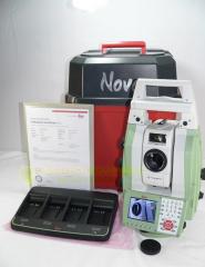
Used Leica Nova MS50 for sale, Angle Accuracy 1”, Reflectorless R2000. Lightly used year 2013, low hours used and still like new, everything is in excellent perfect working order condition. Been shop tested, checked and calibrated by Leica Certified service, ready to go to survey and works great with Leica working standards, the sytem unused stored ready for sale since last service.
Includes;
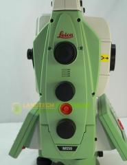
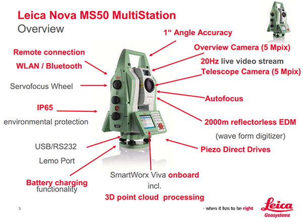
Leica Nova MS50
The world's first MultiStation, new dimension in measuring technology can combine total station functionality, GNSS connectivity, digital imaging and 3D laser scanning in a single instrument. Features outstanding precision, accuracy, efficiency, quality and versatility. The MS50 provides an angular accuracy of 1” (according to ISO 17123-3) and a new optical-distance measurement system (EDM) based on wave form digitizing technology. The EDM measurement accuracy is 1 mm + 1.5 ppm onto prism (according to ISO 17123-4) and 2 mm + 2 ppm for measurements onto any surface.
Leica Nova MS50 embodies 90 years of innovative thinking of Leica Geosystems to develop precise, reliable and flexible technologies.
The Leica MS50 is part of the Leica Nova solution which contains:
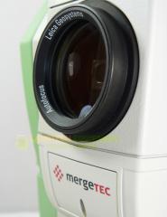
Faster, Better, Smarter, Simpler. These key words describe the benefits of Leica Nova; an unique solution that covers the complete process from capturing and visualising data, taking decisions and delivering. The Leica Nova MS50 includes precise 3D laser scanning, extensive and precise total station capabilities, digital imagery and GNSS connectivity. Thanks to mergeTEC, the Leica Nova MS50 not only combines the hardware but also merges the data itself; images are synchronised with 3D laser scans and the scans tied into total station measurements. The Leica Nova MS50 allows the user to decide on site which measurement technology to use to fulfil his measurement tasks. The results are available directly in the field, for example the volume of a stockpile derived from point clouds which have been scanned with the Leica Nova MS50.
INTEGRATED SCANNING OF EVERY DETAIL
The Leica Nova MS50 integrates 3D point cloud measurements into a regular survey workflow. This lets you collect and visualise your topographic survey data together with detailed high-precision scans. Save time by checking your data for integrity and relevance and avoid costly reworking or returns to the field. Benefit from better decisions with richer and more detailed data.
PROVEN TECHNOLOGY FOR UNMATCHED VERSATILITY
The Leica Nova MS50 provides proven total station functionality with superior sensor integration for highest precision, performance and full automation of measurement procedures. Together with the benefits of GNSS connectivity, the Leica Nova MS50 offers complete versatility by delivering reliable results wherever and whenever you need them.
IMAGE ASSISTANCE FOR EVERY SITUATION
The Leica Nova MS50 features an overview camera and a telescope camera with 30x magnification and autofocus. State-of-the- art image processing technology delivers live fluid video streaming of highest image quality. The imaging capabilities of the Leica Nova MS50 open up new opportunities of operating the MultiStation in an almost infinite range of applications.
LEICA NOVA MS50 MULTISTATION TECHNICAL SPECIFICATIONS
| ANGLE MEASUREMENT | ||
| Accuracy Hz and V | Absolute, continuous, quadruple | 1” (0.3 mgon) |
| DISTANCE MEASUREMENT | ||
| Range | Prism (GPR1, GPH1P) Non-Prism / Any surface |
1.5 m to >10000 m 1.5 m to 2000 m |
| Accuracy / Measurement time | Single (prism) Single (Any surface) |
1 mm + 1.5 ppm / typ. 1.5 s 2 mm + 2 ppm / typ. 1.5 s |
| Laser dot size | at 50 m | 8 mm x 20 mm |
| Measurement technology | Wave Form Digitising | coaxial, visible red laser |
| SCANNING | ||
| Max. Range / Range noise (1 sigma) |
1000 Hz mode 250 Hz mode 62 Hz mode 1 Hz mode |
300 m / 1.0 mm at 50 m 400 m / 0.8 mm at 50 m 500 m / 0.6 mm at 50 m 1000 m / 0.6 mm at 50 m |
| Visualisation of point cloud | Onboard 3D point cloud viewer, including true colour point clouds | |
| IMAGING | ||
| Overview and telescope camera | Sensor Field of view (overview / telescope) Frame rate |
5 Mpixel CMOS sensor 19.4° / 1.5° Up to 20 frames per second |
| MOTORISATION | ||
| Direct drives based on Piezo technology | Rotation speed / Time to Change Face | max. 200 gon (180°) per s / typ. 2.9 s |
| AUTOMATIC AIMING (ATR) | ||
| Range ATR mode / Lock mod | Circular prism (GPR1, GPH1P) 360° prism (GRZ4, GRZ122) |
1000 m / 800 m 800 m / 600 m |
| Accuracy / Measurement time | ATR angle accuracy Hz, V | 1” (0.3 mgon) / typ. 2.5 s |
| POWERSEARCH | ||
| Range / Search time | 360° prism (GRZ4, GRZ122) | 300 m / typ. 5 s |
| GUIDE LIGHT (EGL) | ||
| Working Range / Accuracy | 5 –150 m / typ. 5 cm @ 100 m | |
| GENERAL | ||
| Autofocus telescope | Magnification / Focus Range | 30 x / 1.7 m to infinity |
| Display and Keyboard | VGA, colour, touch, both faces | 36 keys, illumination |
| Operation | 3x endless drives, 1x Servofocus drive, 2x Autofocus keys, User-definable SmartKey | |
| Power management | Exchangeable Lithium-Ion battery with internal charging capability |
Operating Time 7–9 h |
| Data storage | Internal memory / Memory card | 1 GB / SD card 1 GB or 8 GB |
| Interfaces | RS232, USB, Bluetooth, WLAN | |
| Weight | MultiStation incl. battery | 7.6 kg |
| Environmental specifications | Working temperature range Dust & Water (IEC 60529) / Blowing rain Humidity |
–20°C to + 50°C IP65 / MIL-STD-810G, Method 506.5-I 95%, non-condensing |